
RADARSAT Constellation satellites launched and deployed
The Canadian Press
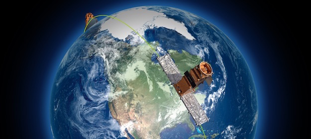
General AerospaceCanadian satellites replace RADARSAT-2 satellite, in orbit since 2007.
(Photo credit: CSA)
The $1.2-billion government-owned project replaces the RADARSAT-2 satellite, which has been in orbit since 2007.
Once fully operational later this year, the three evenly spaced satellites will orbit Earth every 96 minutes at an altitude of about 600 kilometres. They will work in tandem and are expected to generate 250,000 images per year – 50 times more than the first generation RADARSAT satellite.
The new system will provide a major upgrade over its older counterpart, able to revisit an exact point on Earth every four days versus every 24 days for RADARSAT-2.
An official says the first images are expected in the coming weeks and the satellites will serve a wide range of purposes, including monitoring sea ice, maritime surveillance, disaster management and agricultural and forestry management.
The satellite trio will be able to scan Earth day or night and in any weather conditions. They have the capacity to capture an image of a given location on about 90 per cent of the world’s surface, but they will be primarily used to keep tabs on Canadian territory for the federal government.
www.asc-csa.gc.ca